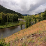
The Rio Grande basin within Colorado is located in south-central Colorado and encompasses approximately 7,500 square miles (U.S. Department of Agriculture 1978). The primary feature of the basin is an open, almost treeless, relatively flat valley floor (known as the San Luis Valley) surrounded by mountains. The valley floor ranges in elevation from 7,440 feet on the south end to 8,000 feet on the north end, and is bounded on the west by the San Juan Mountains and on the east by the Sangre de Cristo Mountains.
 Of the 7,500 square miles, there is an area of approximately 3,000 square miles in the northern part of the valley that does not naturally drain into the Rio Grande because it is separated by a low divide in the shallow ground water table formed by the alluvial fan of the Rio Grande on the west and alluvial material from the Sangre de Cristo Mountains on the east. This non-tributary area is known as the Closed Basin.
The Rio Grande main stem rises in the San Juan Mountains in the vicinity of Creede, Colorado and flows easterly where it is joined by the South Fork of the Rio Grande at South Fork, Colorado. The main stem continues east to Del Norte where it flows out onto the San Luis Valley floor in a southeasterly direction. The main stem continues this path until it reaches Alamosa, where it abruptly turns south and flows to the New Mexico state line.
The U.S. Bureau of Reclamation (USBR) prepared a report in 1947 recommending the construction of Platoro Reservoir in the Conejos River basin. This reservoir was built from 1949 to 1951 with a capacity of approximately 60,000 acre-feet that includes a 6,000 acre-foot flood pool. Platoro Reservoir is decreed for 53,571 acre-feet. Because this reservoir was built after the compact was signed, it is referred to as a post-compact reservoir and is subject to special restrictions under the compact. The U.S. Army Corps of Engineers assumes operation of Platoro Reservoir during flood control situations.


